Optimizing Urban Parking with AI-Powered Drone Analytics
Partner: Parkalytics
Date: Continuing
Location: Worldwide
Project Overview
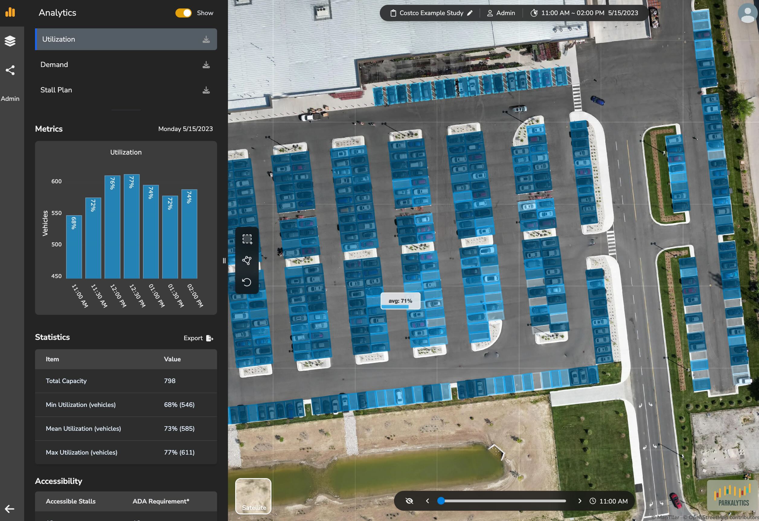
Parkalytics, a leader in smart parking solutions, required accurate and detailed data for effective long-term planning. However, conventional data collection methods were costly and lacked the necessary granularity
Project Kiwi implemented AI-powered drone analytics, significantly enhancing the cost-efficiency and detail of parking data acquisition for Parkalytics. This improved data empowers Parkalytics to make better-informed strategic decisions for optimizing urban parking infrastructure.
The Challenge
Optimizing urban parking using aerial imagery presents several complex technical challenges:
- Accurate Vehicle Detection: Reliably detecting vehicles of various types, sizes, and colors under diverse lighting and weather conditions from aerial perspectives.
- Precise Localization: Determining the exact geographic location (latitude, longitude) of each detected vehicle within the parking area, accounting for image distortion and perspective.
- Temporal Analysis & Trend Identification: Effectively 'stacking' localizations from multiple drone flights over time to track individual parking space occupancy, calculate dwell times, and identify long-term usage trends and patterns.
- Scalability & Efficiency: Processing vast amounts of image data efficiently to provide near real-time insights across large urban areas without prohibitive computational costs.
- Data Integration: Combining aerial analysis with other data sources (e.g., payment systems, ground sensors) for a holistic view of parking dynamics.
Our Solution
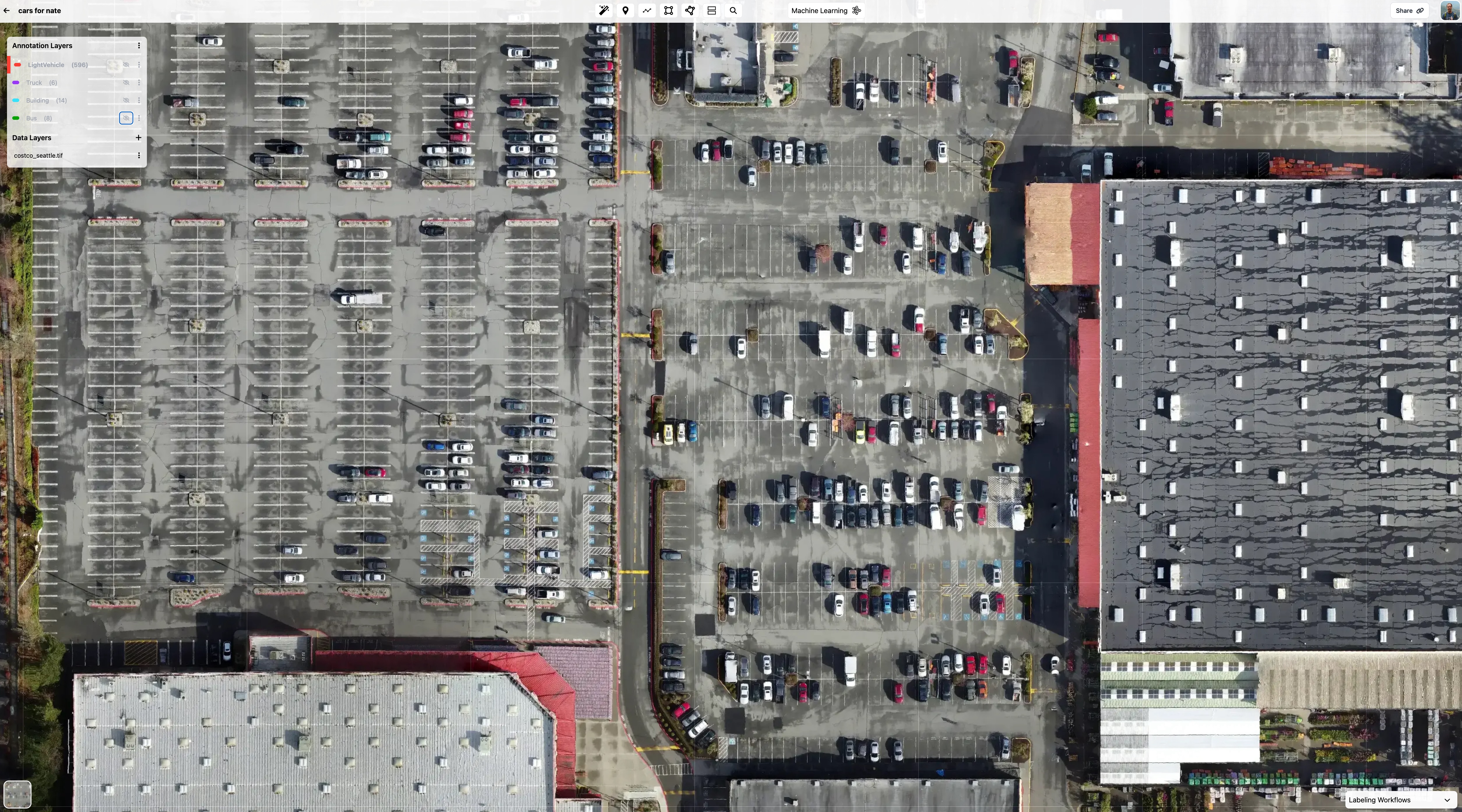
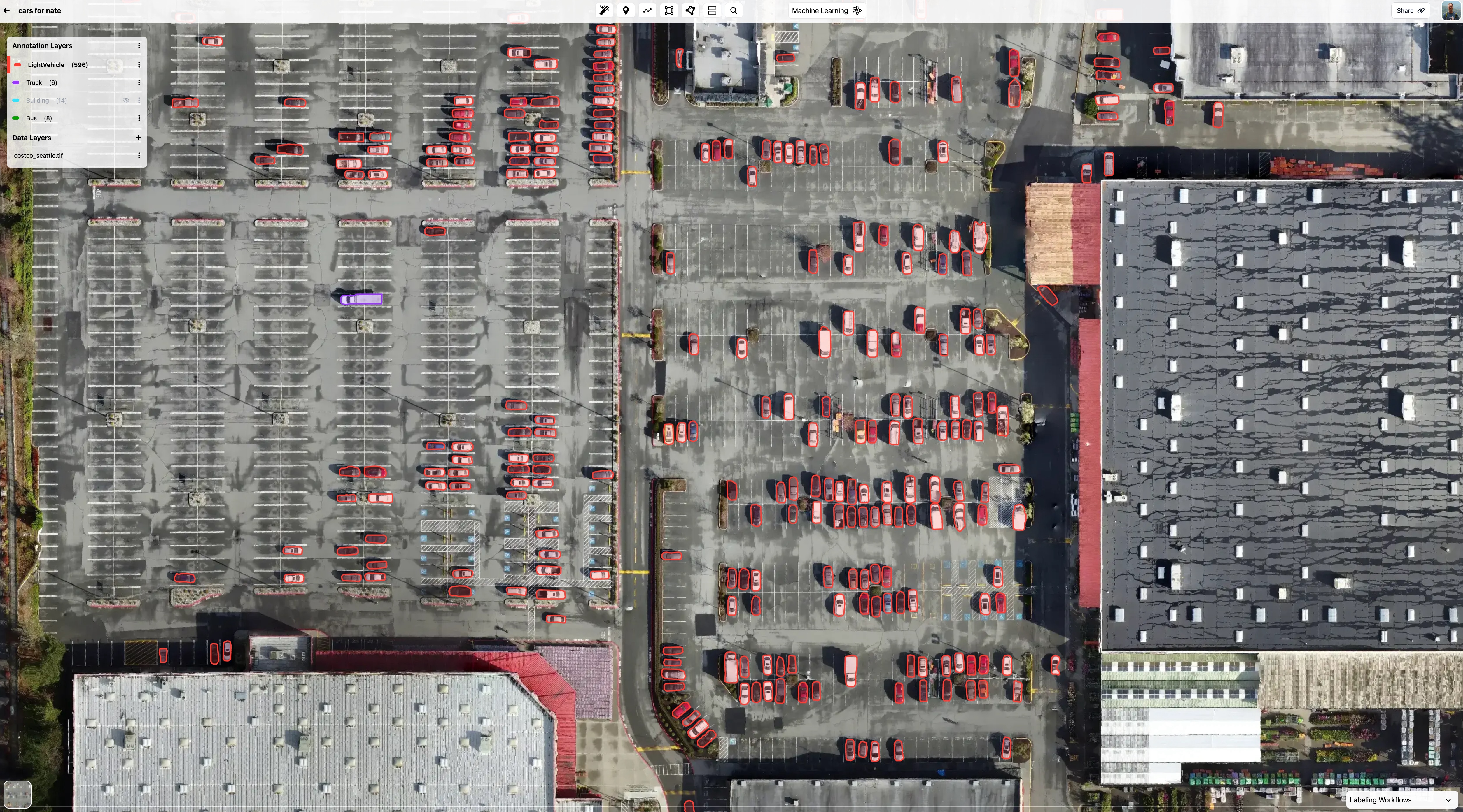
Automated vehicle detection and counting
Project Kiwi provided Parkalytics with a scalable and accurate drone-based analytics platform:
- Automated Drone Data Processing: Ingesting high-resolution aerial imagery to create detailed maps of parking areas.
- AI-Powered Vehicle Detection: Accurately identifying individual vehicles.
- API Integration: Providing seamless integration with existing parking management systems and third-party applications via robust APIs.
- GIS Standard Outputs: Delivering analysis results in standard geospatial formats (e.g., GeoJSON, Shapefile) for easy use in GIS software and workflows.
Driving Smarter Cities
"Project Kiwi has been a fantastic technology partner, though their API docs could use some love."
— Michael Thoreau, Co-Founder, Parkalytics
Conclusion
The collaboration between Project Kiwi and Parkalytics demonstrates the power of AI and drone technology to gather detailed parking data. This insight informs smarter urban planning, helping cities reduce parking dependence and optimize land use for more sustainable development. We continue to innovate together with Parkalytics in urban land management.

Michael Vaux
Chief Code Monkey at Project Kiwi