Annotate, and Collaborate with Drone Data.
Identify and map everything from invasive species to industrial waste. Project Kiwi is the only platform that is designed for finding needles in haystacks.
Get started for freeDesigned to get the most from Drone Data in Natural Environments
Mapping natural environments, including tree canopies, is challenging! With Project Kiwi, you can quickly cross reference between raw images to get the most out of your data.
Collaborative Labeling, bring your team.
Project Kiwi was created to get human eyes across every square inch of data. As simple as sending out a link, you can invite your team to contribute to your project.
Applications and Case Studies
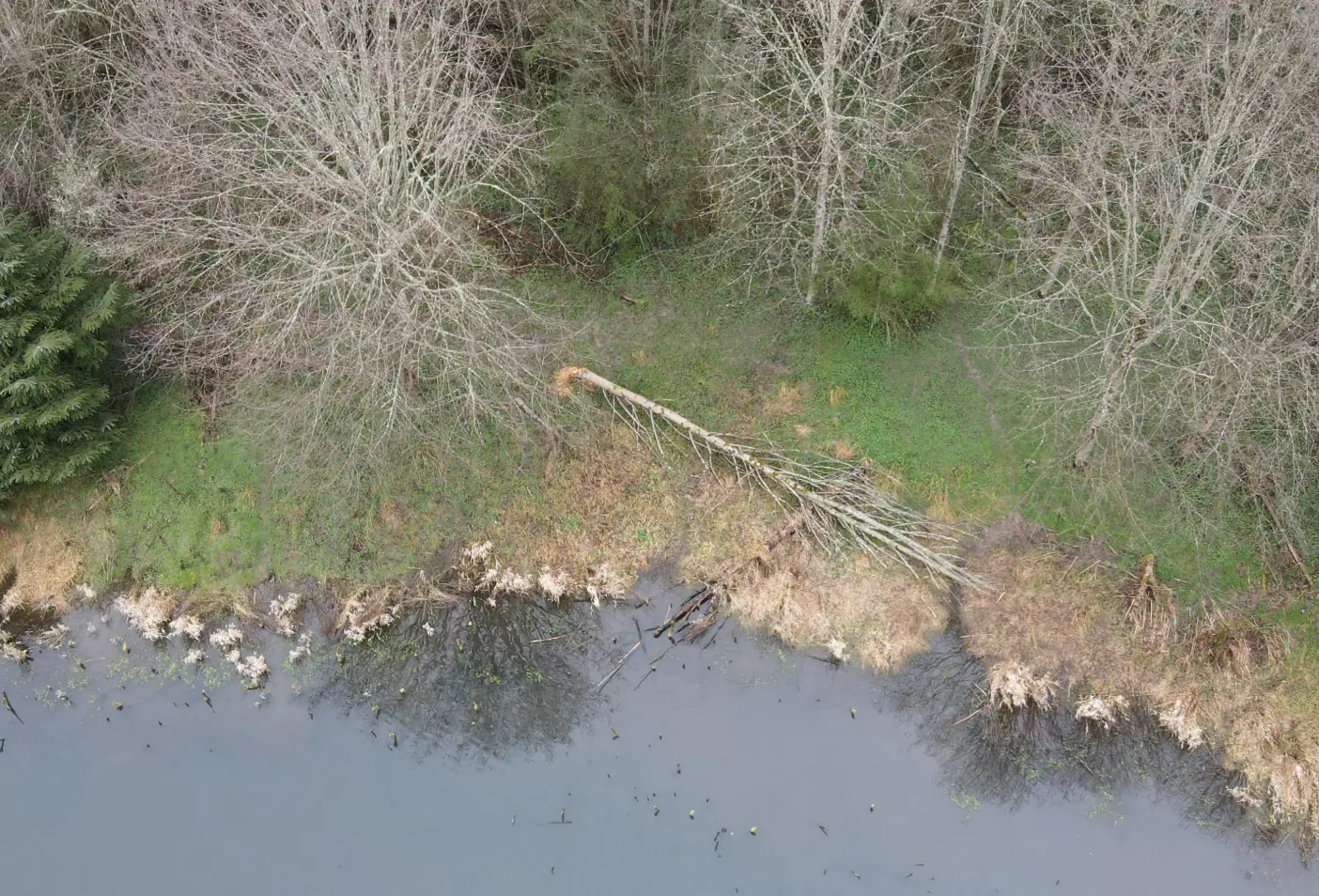
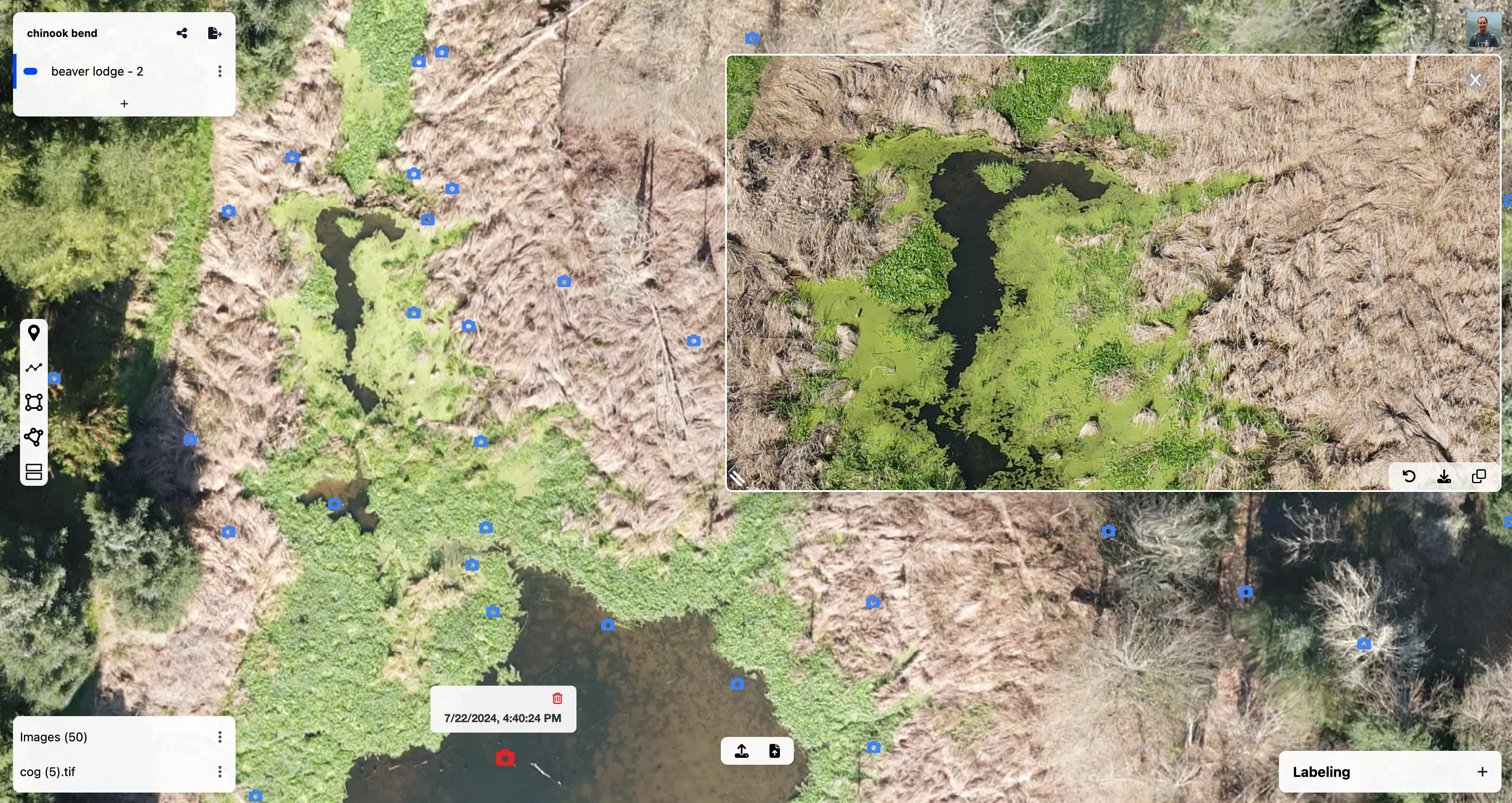
Monitoring Beaver Populations
How drones helped identify and track signs of beaver activity in riparian habitats.
Read more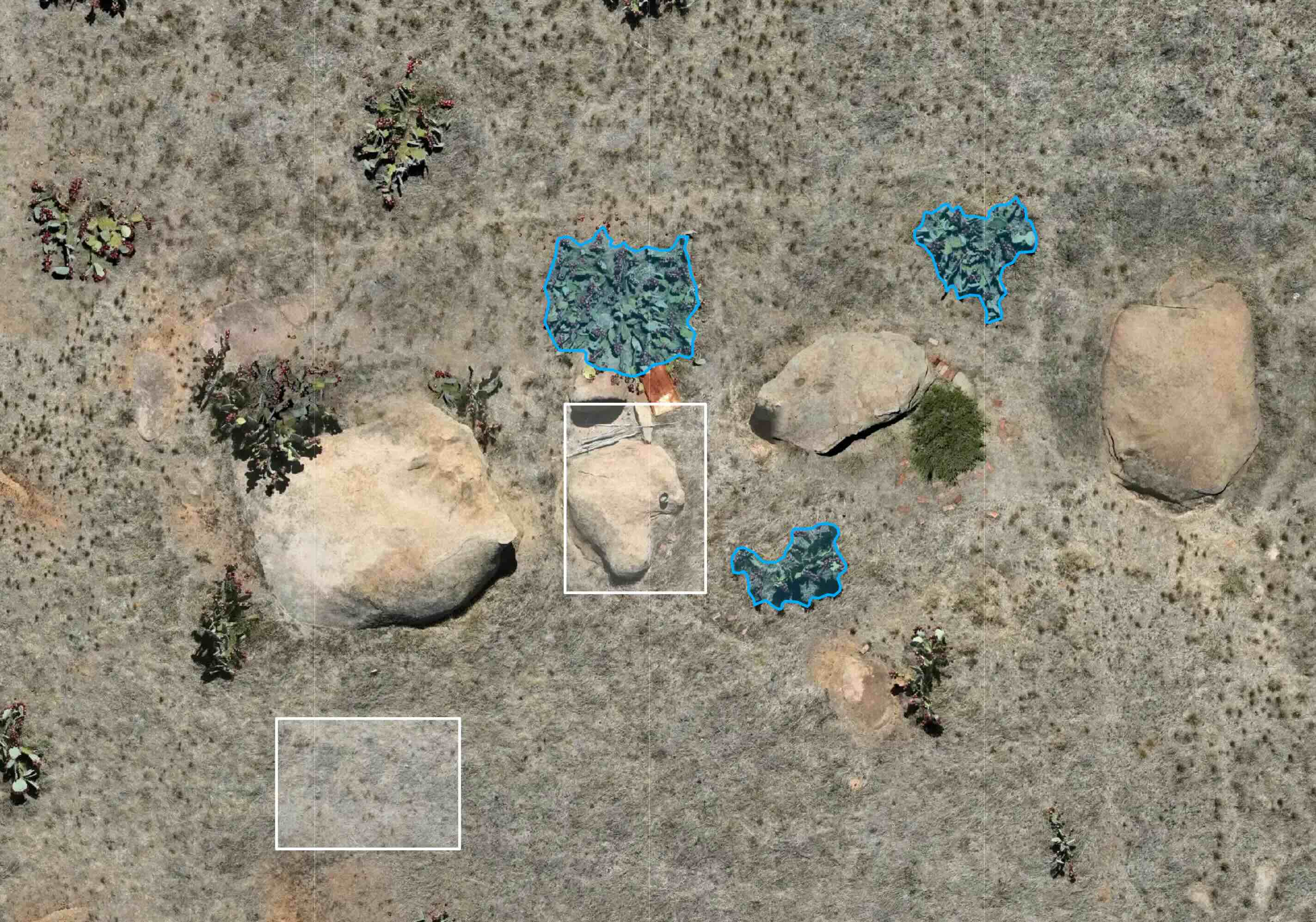
Invasive Species Mapping in Victoria
How drones can be used to map large areas of invasive cacti with high precision.
Read more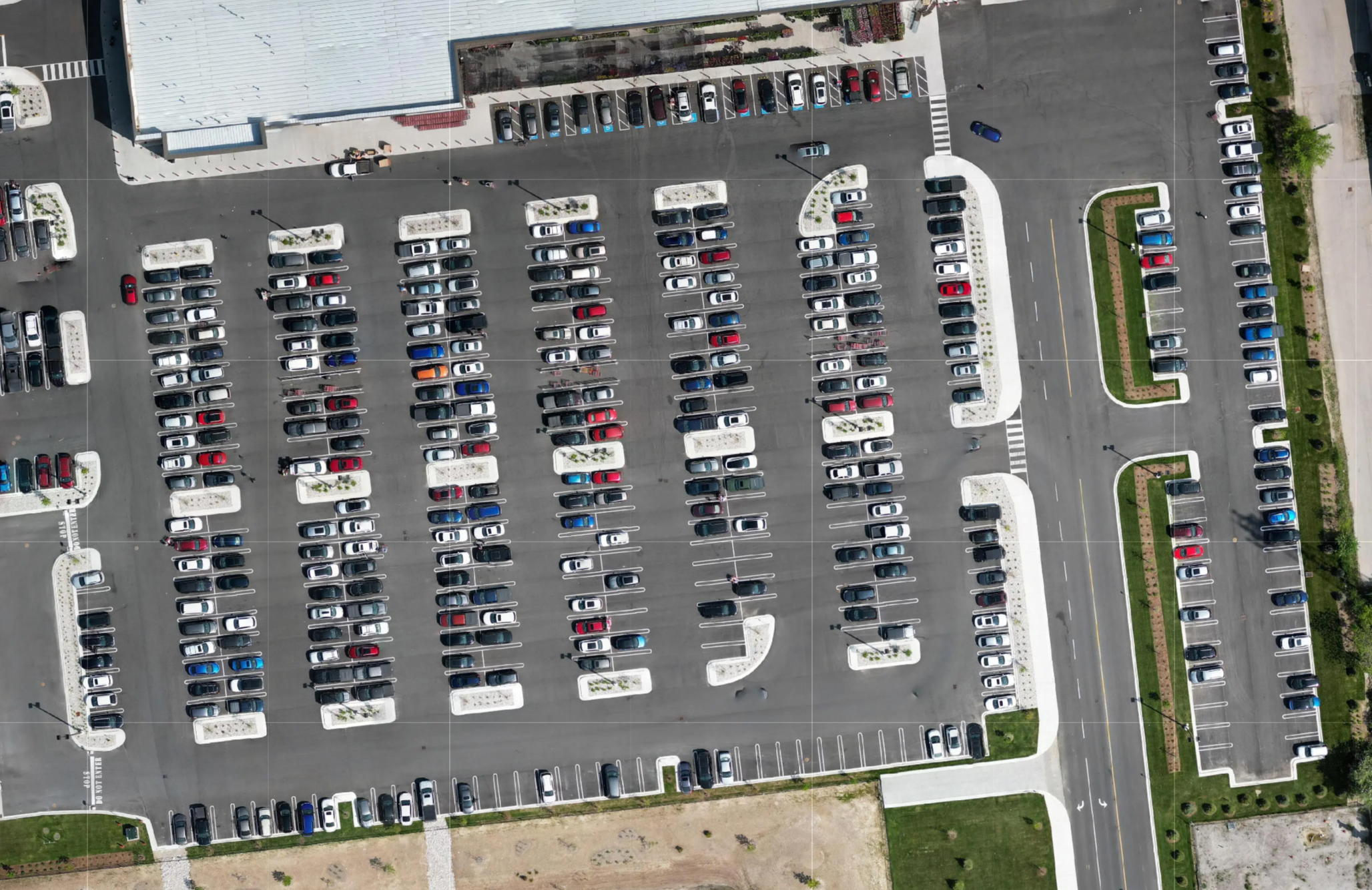
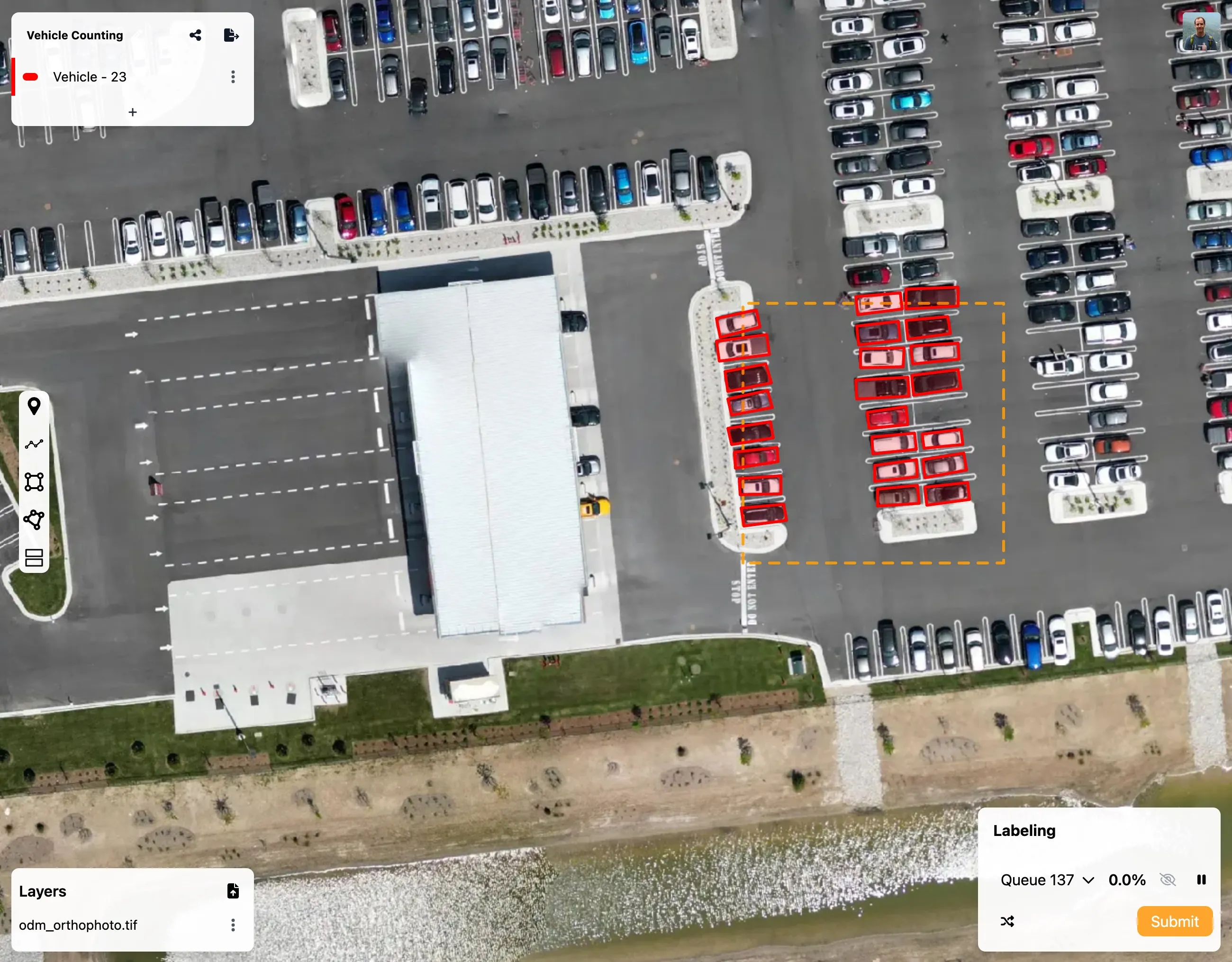
Transportation Studies with Drones
How engineers use Project Kiwi to measure parking demand and utilization.
Read more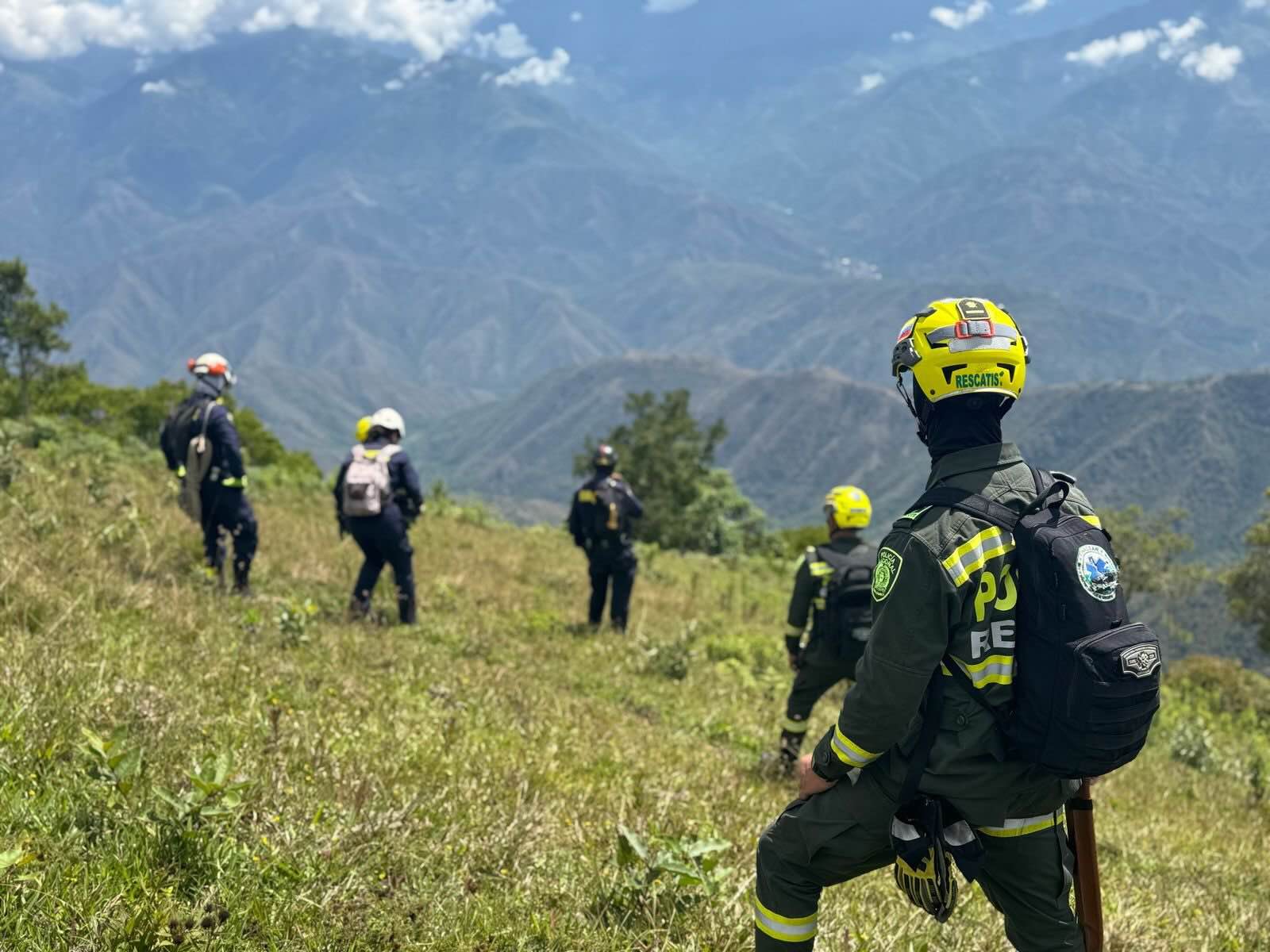
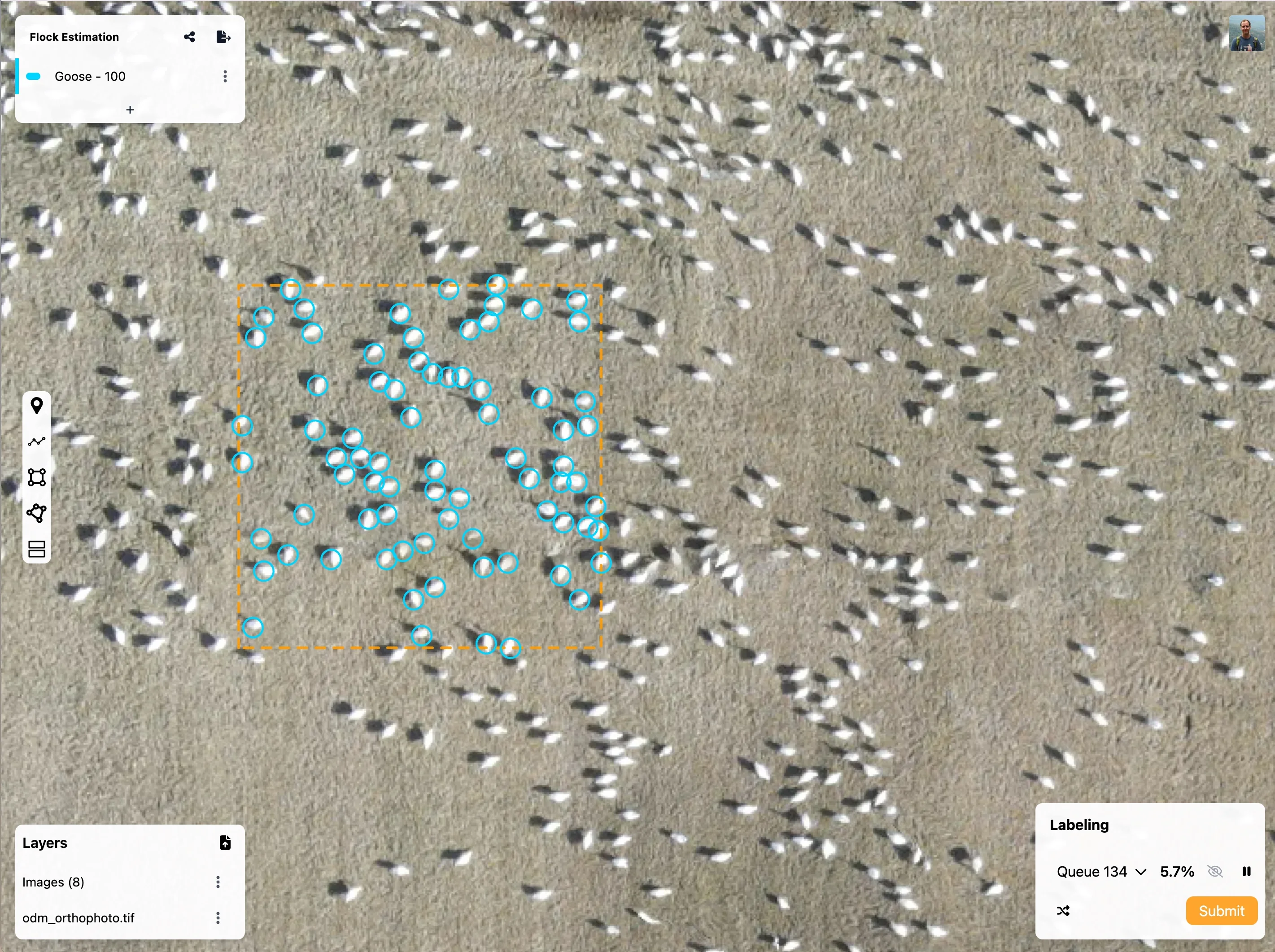
Crowd-Sourced Search and Rescue
How 500 volunteers can work together to find missing persons in remote environments.
Coming soonImpact Driven Pricing
Project Kiwi is simply designed to be the most accessible way to extract insights from drone data, our pricing reflects this goal.
Community
- 100 Images
- 300MB Raster Data
- 5 Projects
- Unlimited Exports
Starter
- 5k Images
- 10GB Raster Data
- Unlimited Projects
- Unlimited Exports
Professional
- 20k Images
- 200GB Raster Data
- Unlimited Projects
- Unlimited Exports
10% of all software sales go to supporting the various open source projects that make our work possible. Learn More.
Want to chat?
Book a quick call with us to chat about projects, use cases, or just get a demo!